


Hackathon Newbie | Looking GLOBE-ally
The Challenge | Looking GLOBE-ally
G.E.O.S.
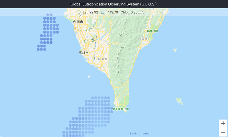
We want to manage and observe rivereutrophication effectively. We are using remote sensing data to observe thechlorophyll concentration in the estuary, and then to calculate eutrophicationof the river, based on the concentration of eutrophication to define grading. Wedeveloped a website and a mobile app to integrate daily satellite data intoGoogle Maps, and visualize this information to users or government concernedwith this topic, so that users can more easily browse the information. ProvideSubscription function to track the update status of the data.
API Server Repository: https://github.com/hackathonewbie/api-server
Web App Repository: https://github.com/hackathonewbie/web
Web Demo: http://ec2-54-255-197-171.ap-southeast-1.compute.a...
Mobile App Repository: https://github.com/hackathonewbie/App

SpaceApps is a NASA incubator innovation program.