


V.A.L.M. Exploration | The Land Where Displaced People Settle
The Challenge | The Land Where Displaced People Settle
IDP informal settlement research optimisation
How to use armed conflicts observations and satellite data to optimise the research of internally displaced people informal settlements in order to provide humanitarian help as soon as possible.
Our main goal is ideating an app or a website that, receiving simple inputs from the user as battle and bombardment locations, and autonomously collecting data from NASA satellite observations, could create a mathematical representation of displaced people's movements during an armed conflict.
This mathematical description would indicate the most relevant areas to conduct the search for internally displaced people informal settlements, which can be carried on with satellite data analysis on a restricted scale, speeding up humanitarian help.
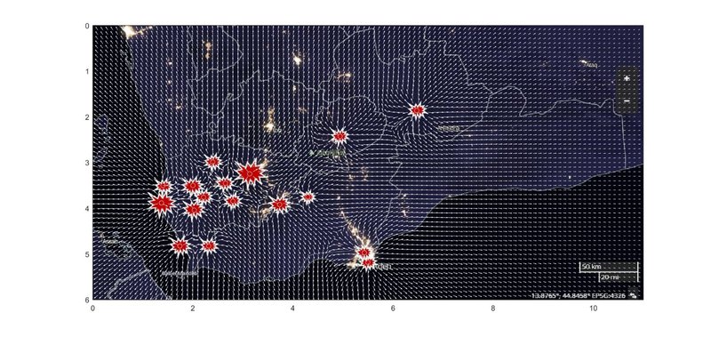
On a map of the war zone, we wanted to calculate a vector field generated by dangerous events, natural obstacles, safe zones, and much more, each with their own weight. The information could come from user input, satellite data, previous conflict patterns as well as social studies.
The task was too complicated for our limited skills and time, but we focused our efforts on a simplified example in order to show the potential of the idea.
For more information, we'll upload a more extensive description report on github, as well as the code example at the following link:
https://github.com/Gaulz/VALM-Exploration
Resources:
EOSDIS Worldview – NASA (Nighttime pictures)
Earthdata – NASA (Landsat, Modis data)
ACLED («One year of battles in the Yemeni civil war»)

SpaceApps is a NASA incubator innovation program.