


AirHive | Health Makes Wealth
Awards & Nominations
AirHive has received the following awards and nominations. Way to go!
The Challenge | Health Makes Wealth
AirHive
Design sensors to get high definition air quality data and sensitize people about environmental health.
What if we had all the air pollution data we need?
We understood that there are two critical issues that hinder the global community from fighting against climate change and the problems related to pollutants’ increase.
The first problem is that we do not have enough air pollution sensors around the world, thus right now we cannot create a high-resolution pollutants map.
The second problem is that people do not seem to completely realize that environmental health is so critical and at risk.
To solve these problems we have designed a network of cheap IOT devices that can be placed everywhere. We called these devices WeatherBees.
Accessing Air Quality Data
Everyone will be able to access our Air Quality Data: developers through our APIs and users from our app.
WeatherBees mapping plan
WeatherBees are cheap enough to be placed in every street. However, we believe that the best pattern is made of hexagons:
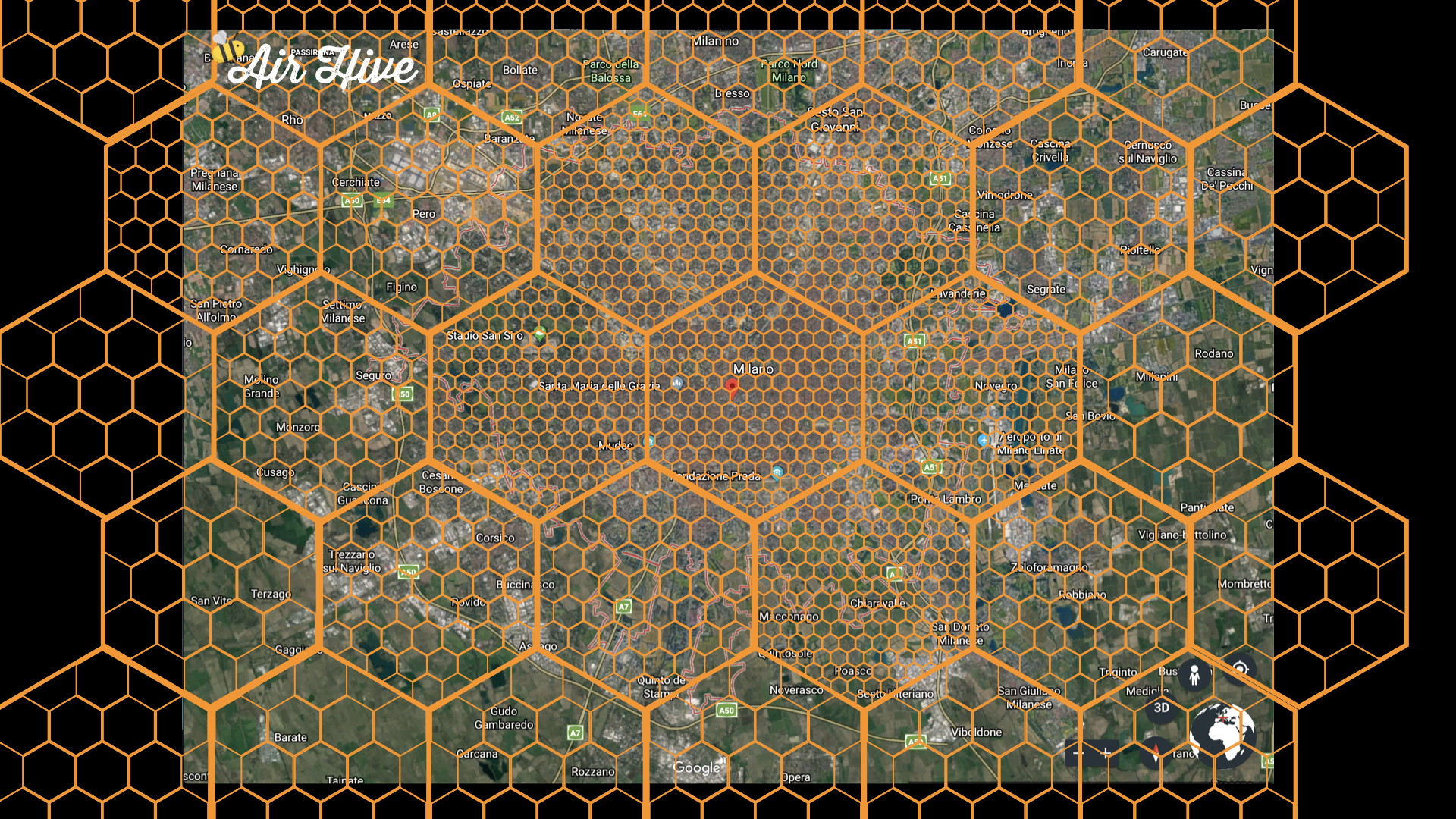
Ideally there should be at least one WeatherBee inside each hexagon. As hexagon size depends on the population density, using satellite images in the future can help improving hexagon map design.
How WeatherBees will look like
This is a digital render of our WeatherBee, it will be made of recyclable materials:
Our app and our website will show users what the current and historical levels of air pollution nearby are and sensitize the users about air pollution, with pages dedicated to various types of pollutants.
AirHive can also detect and manage emergencies
If AirHive detects values out of the ordinary (temperature out of the standard deviation, a rise in CO2 level... is that a fire or is my roommate cooking?) it immediately warns users nearby. If the anomaly persists and gets detected by other devices nearby a "state of emergency" is declared and local authorities are alerted.
In the future, we plan to merge collected data and weather data to predict, in case of emergency, using a recurrent neural network, emergency's most probable path and warn not only users nearby but also those who are on the emergency's most probable way.
WeatherBees' first schematic
Below WeatherBee's first schematic, we plan to improve it drastically in the future.

AirHive Project presentation
Important links
Local weather data samples from ArpaLombardia
Our GitHub repository: https://github.com/giuliovv/AirHive
Project website: https://www.airhive.it
AirHive Public APIs: https://www.airhive.it/api/

SpaceApps is a NASA incubator innovation program.