


Radix | Spot That Fire!
Awards & Nominations
Radix has received the following awards and nominations. Way to go!
The Challenge | Spot That Fire!
Wildfire, Spot that fire!
A crowdsourcing based app to share risks of fire and fires in real-time, sharing this data with all connected users. Besides, the app get weather information and fire reports to warn the users about the possible risks of fire in their area.
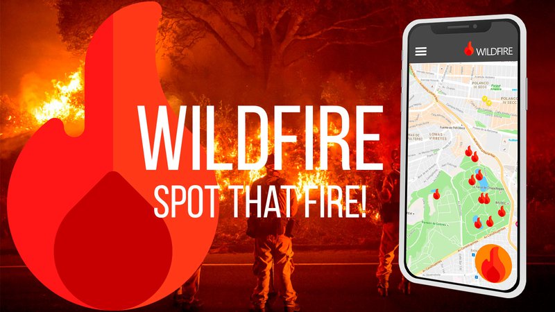
SPOT THAT FIRE!
Over the past year, we have witnessed long and arduous battles against record-breaking wildfires across the world. Some of these fires burned thousands of acres of land and destroyed hundreds of homes and buildings. Additionally, smokefrom the fire creates issuesrelated to poor air quality, raising health concerns for people not just in the vicinity of the fire, but at distances hundreds of miles away.
With this in mind, we present the solution: Wildfire!
Wildfire isa crowdsourcing based app to share fire risks and fires in real-time, sharing this data with all users. Besides this, the app get weather information and fire reports to warn the users about the possible risks of fire in their area.
https://github.com/andreluizmelo/wildfire
WHY?
+1,3Mfires
+3,000deaths
+15000injuries
+US$14 billionloss
(U.S. Fire Administration 2015 data)
MAIN FEATURES
- Report different types of incidents (Fire, Risk of Fire, Others)
- Predictive warning - Be warned about the risk of fire in your area, based on:
- Historical incidents
- Temperature
- Wind speed
- Report incidents directly from your camera or gallery
- Be informed about the incidents reported in yourarea, from:
- NASA
- 911
- Other users
The map of reported incidents is also available on a web platform.
HOW IT WORKS?
Getting and correlating data from:
- NASA (FIRMS - Fire Information for Resource Management System)
- Getting updated fire locations every 3 hours
- We used a dataset of +300,000 datain the last 7 days
- San Fancisco Emergency Calls
- We used a dataset of +900calls of fire emergency for this month(Oct/2018)
- Wildfire
- Real-time shared data based on crowdsourcing
- OpenWeatherMap - real-time and historical data of
- Temperature
- Pressure
- Wind Speed
BENEFITS
- Firefighters warned faster, reducing the damage
- Avoid wildfire spreading to large areas, decreasing environmental impact
- Extinguish the fire quickly, reducing the number of affected people
THINKING OF THE FUTURE
- Get data from other data sources: emergency calls, organizations...
- Improve the predictive model for a bigger range of forecast
- Dashboard for the authorities tracking the incidents
- SMS notification for people in risk areas
- Chatbot for campaigns and to answer questions
- Use the accelerometer and GPS to identify if people in risk area are moving out of the area
- Link to Facebook to use the “I’m safe” feature
- Future use for other incidents like tsunamis, earthquakes, storms, hurricanes, landslide...

SpaceApps is a NASA incubator innovation program.