


Light Wonder | Polar Opposites
Awards & Nominations
Light Wonder has received the following awards and nominations. Way to go!
The Challenge | Polar Opposites
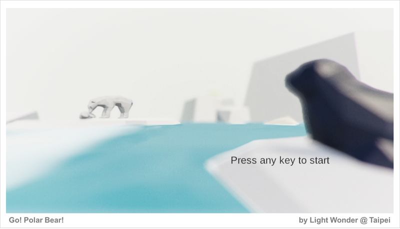
Go! Polar Bears!
Go! Polar Bears! is a game which performs the beauty of data and engages an user with interacting.
[Introduction]
We build a polar bear survival game in REAL Arctic world !
The game built in series maps of Arctic in different years (2007, 2010, 2016), with real ice, real sea boundary, real ecology and environment.
The normal data visualization tools can only 'PROVIDE' data. For a general audience, these data are just some numbers and maps, and means nothing to them. Even they understand how to access, they still don't know what should be found within the content.
To engage the user interacting with the data, we believe that the game is the best way of presenting. By performing the change of time and space, players can act as a polar bear to explore and realize what happen to Arctic Cycle.
SlideShare : Slide Share - Go! Polar Bear!
[Game Play]
[NOTICE !] The demo requires browser support WebGL. All major desktop browsers such as Google Chrome, Mozilla FireFox, Apple Safari and Microsoft Edge can support WebGL .
Demo Game Link : --> Let's play!
User Manual:
[Game Concept & Design]
Global warming has had a huge impact on the environment, climate, and ecology of the North Pole.Level Design
In the game, you can become a polar bear of different ages as you go on various quests to explore the Arctic of 2007 to 2016.
Level 1:
The ecological system is balance and stable. Arctic Circle is full of sea ice and various creatures. Polar bears live in excellent condition and stand on top of the food chain here.
Player acts as a baby polar bear. Just walk around to explore the fascinating polar nature spectacle. Don't leave mother bear too far away, and you'll complete this level.
LEVEL 2:
Global warming has changed the environment of the polar circle dramatically. Polar bears' activities are restricted by the decreasing sea ice. It is full of hunger adult bears who will even hunt the helpless youngs in the polar bear group now.
Player acts as a mother polar bear. You not only must hunt seals to feed bady bear, but also protect baby bear from other hungry adults. Baby bear is hard to survive in the difficult situation. Once the baby bear is gone, you'll enter the final level!!!
LEVEL 3:
LIving conditions are getting worse continually. A few years later, there's only one polar bear lives in the area. Player acts a lonely, hungry, and elderly polar bear. The sky is same as its childhood, but everything else has changed ...
[Real Arctic Simulation]
We learned that the polar bear population is declining in 3 areas of Arctic, including Baffin Bay, Kane Basin and S.Beaufort Sea from Polar Bears International. Therefore, we choose a bay located in North-West Canada as the region that we present in the game.
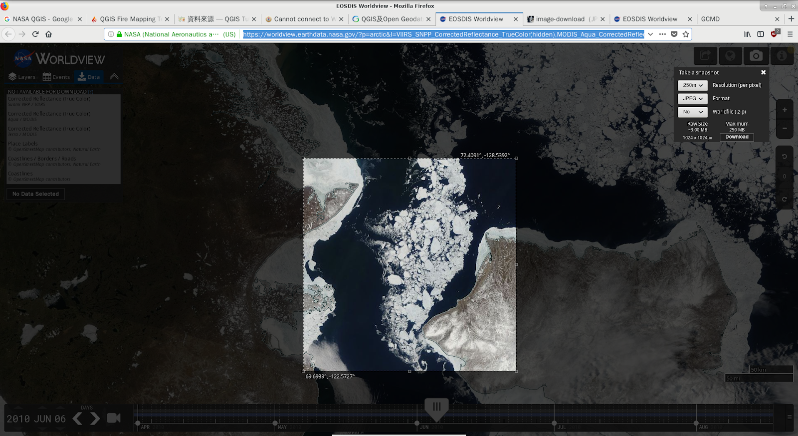
- We randomly picked some area on the map and dumped historical images from EOSDIS Worldview. The region, which we present in the game is in the square of (69.6939, -122.5727) and (72.4091, -128.5392) is perfect to present the change of climate, ice-free & land ratio.
Generate 3D Terrain Model
To perform the polar bear in different age and how it suffer environment change, we selected maps in year of 2007, 2010, 2016 as different game level's terrains and landscapes.
Image from ArcGIS
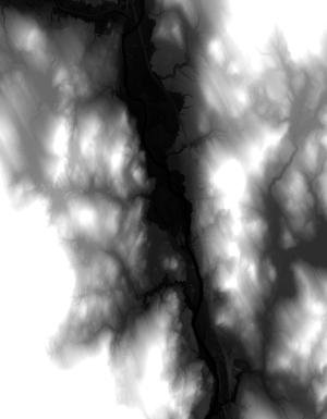
We found there are a lot of landform data from ArcGIS. For example, the GeoTiff which we can open with QGIS represents altitude in grayscale.

To transform the GeoTiff (DEM) or image into a terrain model for the 3D program, for example: Unity, someone has already implemented the tool: phstl, which transfrom GeoTiff (DEM) file to STL file.
However, most of the data is around the land, not the sea/ocean, which we are more interested in for the challenge. Therefore, we put the eyes on NASA EOSDIS Worldview.
Image from NASA EOSDIS Worldview
We even downloaded the images in the same area but on different dates with cURL in batches. We wrote the shell script - getpics.sh for that.
Image Processing for Terrain Model (with OpenCV, Matplotlib and NumPy)
Photographers always check the histogram which shows the brightness distribution of the pictures that they take. We try to find the sea/ocean and ice/snow in the downloaded images with the same idea.
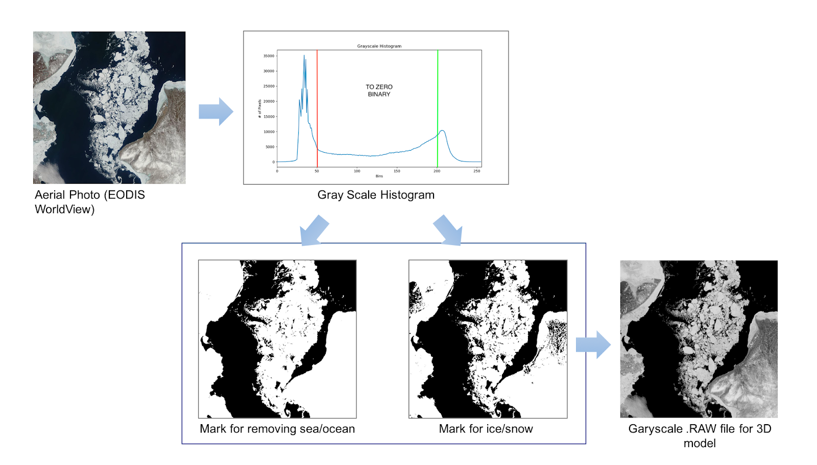
- Get the original image from Worldview.
- Have the histogram of the original image with OpenCV and plot it with Matplotlib.
- Sea/ocean is dark blue which is in dark part of the histogram.
- Ice/snow is white which is in the bright part of the histogram.
- We can get the masks with the binary method: Apply thresholds on the original image in grayscale. Red line is for sea/ocean; green line is for ice/snow. These methods can also be used for Arctic waterway.
- We not only distinguish the ice and sea (also land), but also make more varied landform in the game by setting by the sea/ocean part as 0 in grayscale.
- Finally, export the processed image in grayscale as a RAW file for the terrain model with GIMP.
We arranged the processes 2 ~ 4 mentioned above in findice.py.
Polar bear distribution
We have referred to the following information to estimate how many polar bears distribute in the area.
The reference data of polar bear population in selected region could be found in the statistic.
According to our design, the region we selected is in the Southern Beaufort Sea area, where the population includes 1,526 polar bears in 2006, but 907 in 2010, and removal 83 per year between 2010 to 2014.
The overall polar bear status of different areas in Arctic is presented in following pages:Other Species Distribution
Other mammals or marine species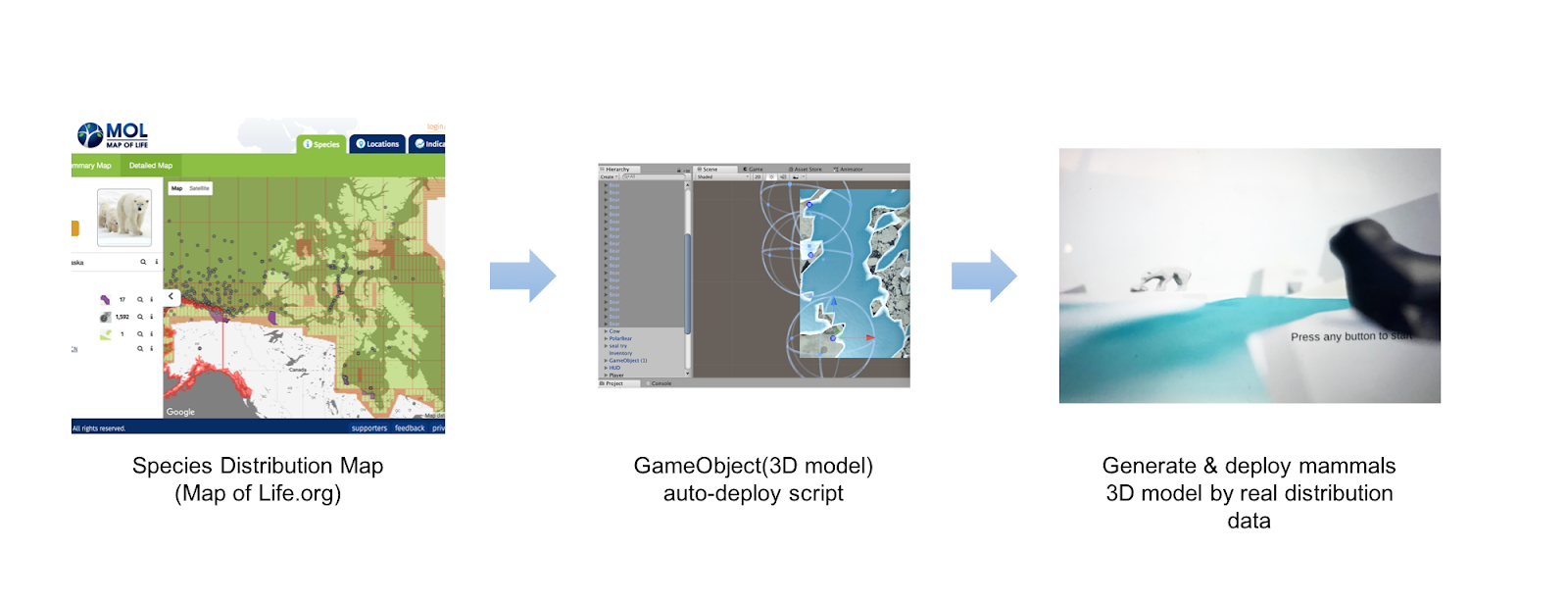
- Seal (Ringed Seal)
- Ovibos moschatus
- Reindeer
- Whale
- Fish
When it is easy to hunt and the polar bear's health is in good condition, the bear may only eat the seal's blubber and skin. Therefore, we also surveyed the Ringed Seal's population, which is also declining in S.Beaufort Sea area.
- Marine Mammal Laboratory - Polar Ecosystems Program: Ice Seal Distribution Data
- NOAA Fishers - Marine Mammal Stock Assessment Reports by Species/Stock
Vegetation
We also suggested to implement the vegetation distribution besides the marine mammal species. We found NASA has telemetry data for vegetation: NASA Studies Details of a Greening Arctic. The data could be implemented as the texture of terrain models, or game objects generated by scripts.
[Prospect]
- Explore and uncover more exciting interaction designs between data and the users.
- Open-source the game design to engage more users to join the group to design more game levels, to discover new applications in data and thereby improve the tools.
- Our climate has been constantly under the impact of human activities. The game is meant to serve as a reminder to human beings: Namely, while striving for constant economic growth, we should also do our part to mitigate climate change and reduce its impact on our environment. We can always try to find ways to contribute to the sustainable development of our world.
[Source Code & Binary]
All the source code & binary we built are listed as follows.
- Image Processing for Terrain Model : https://github.com/starnight/NASA2018HKT/
By 3D game engine Unity's EULA, we can't share complete Unity project & package, so we provide our work's code snippet on the gist.github, including Camera Controller, Followers.
- Game Controller Code Snippet : https://gist.github.com/ones0318
- GameObject (Animal 3D Model Distribution) : https://github.com/ones0318/NASA2018HKT
- Game Binary : https://ones0318.github.io/NASA2018HKT/
[Open Source API/Library]
- [Github] DTM2MESH
- [Github] stl_tools
- [Github] phstl-master
- [Github] dem2obj
- [Github] Qgis2threejs
- [Github] Three.js-STL-Viewer
- GIMP
- Blender
- OpenCV, Numpy, Flask
[Data Source/Reference]
- NASA EOSDIS Worldview - Earth Observing System Data and Information System
- Arctic DEM – University of Minnesota
- USGS - U.S. Geologic Survey
- LandSat – NASA
- GDAL - Geospatial Data Abstraction Library
- QGIS project
- GIBS - Global Imagery Browse Services (NASA)
- Polar Bear Information & Distribution
- Ringed Seal Information & Distribution
3D Model Assets:
- Low Poly Seal 3D Model (CC License) https://cults3d.com/en/3d-model/game/low-poly-seal
- Ship 3D Model (free) https://www.cgtrader.com/items/94184/download-page
Computing Power
- Amazon EC2

SpaceApps is a NASA incubator innovation program.