


terra | Artify the Earth
The Challenge | Artify the Earth
Terra Pop-up Book
Christopher Columbus discovered North America was Italian, so in honor to him we decided to name our team “Terra” which means Earth in Italian, and follow his way and give the world “Terra Pop-up book”.
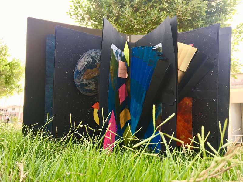
The challenge we chosen is to creatively collect NASA Earth pictures to illustrate Earth’s lithosphere, atmosphere and biosphere. We chose this challenge because it’s more important to understand the planet where we live more than any planet as if we know more about our planet we will know more about others and also to describe our planet.
The challenges that faced us was the printing as at first we did not find suitable printer shops to print the pictures and the material of the paper.
Design requirement:
Our aim in this project is to achieve our design requirement which are:
- The quality: by put NASA’s pictures in high quality “HD” which make the pictures better.
- Safety: by taking care when you use cutters and scissors and avoid hurt yourself.
- Accuracy: using different measuring tools when you measure something to be more accurate when you measure the dimensions of the pictures.
- Low cost: by searching about different book stores and compares their pries and choose the one who has high quality and low cost.
Resources:
NASA Global Imagery Browse Services (GIBS): https://earthdata.nasa.gov/gibs
NASA’s Earth Science Data Systems Program: https://science.nasa.gov/earth-science/earth-science-data
NASA Earth data Search: https://search.earthdata.nasa.gov/
The NASA Scientific Visualization Studio: https://svs.gsfc.nasa.gov/

SpaceApps is a NASA incubator innovation program.