


Sherifii | 1D, 2D, 3D, Go!
The Challenge | 1D, 2D, 3D, Go!
Create and deploy web apps that will enable anyone to explore Earth from orbit! Visualize Earth science satellites and mission data using interactive virtual globes, such as NASA’s Web WorldWind. Use data sets from NASA’s Open Data Portal to present fire, ice, clouds, meteorites, or water temperature spectra.
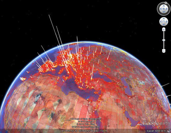
Heatmap for Data Analysis
Visualization tool for data analysis with heatmaps for where asteroids have fallen based on their weight. The Data has been converted and has been processed using unsupervised machine learning algorithms.
Visualization tool for data analysis with heatmaps for where asteroids have fallen based on their weight. The Data has been converted and has been processed using unsupervised machine learning algorithms.
We have used the NASA Web WorldWind API for the globe: https://worldwind.arc.nasa.gov/
We took data from: https://data.nasa.gov/browse
We used python sklearn library to try too find a possible pattern in the meteorite data.

SpaceApps is a NASA incubator innovation program.