


Segmentation Fault | 1D, 2D, 3D, Go!
The Challenge | 1D, 2D, 3D, Go!
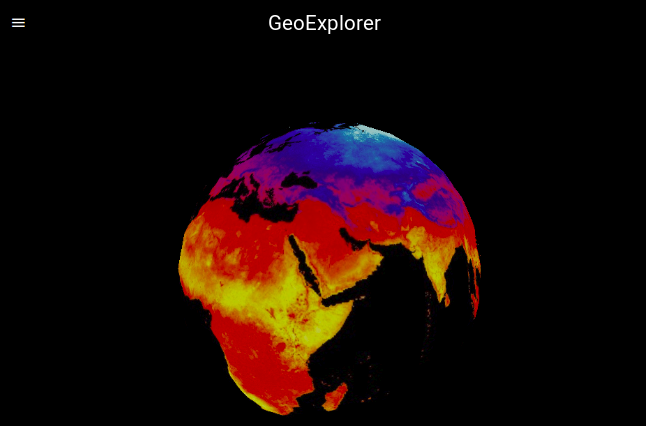
GeoExplorer
GeoExplorer is a web application developed for the Space Apps Challenge 2018 that allows the visualization of open data from NASA and other institutions.
ABOUT GEOEXPLORER
is a user-friendly web app that shows a world map in which the user can see events such as earthquakes and wildfires (current and past) as well as different layers with information about average temperature, clouds, snow and ice, ocean depth and a fabulous true-color view of the Earth.
The main goal is to provide the user a comfortable and intuitive experience to visualize updated data referred to our planet. Also there is a real-time calculation of the current position of several notable satellites including the ISS. While not enabled on this version, it is possible to let the user choose which satellites they want to track.
ABOUT THE EVENT
Space Apps Challenge 2018 was a collaboration event focused on space exploration that on October 19-21 simultaneously on over 180 cities around the world.
This app was developed in the Mendoza local event which took place in the Universidad Tecnológica Nacional - Facultad Regional Mendoza.
ABOUT US
We are Gonzalo Fernández, Gonzalo Romero and Gino Avanzini, students of Mechatronics Engineering at Universidad Nacional de Cuyo. We are interested in software, data analysis and open-source development. This is our first Space Apps Challenge and we are very enthusiastic.
FURTHER WORK
- Provide links to fundraising campaigns to help the affected victims of the disasters shown in the globe (earthquake, wildfires, etc.) While this not the main purpose of the it can become a tool to link the victims with the people willing to help. This could grow up organically into a more sophisticated global disaster-tracking app that pursues that goal.
- Develop mobile app
- Show more information about events (satellite name, country of origin, event location, etc.)
- Provide more event flexibility: how many to show, how back in time, type of event, etc. All available through the NASA API.
- Let the user decide which satellite wants to see or track. Calculate and visualize orbits.
- In the mobile app notify the user if they want to know if any satellite is passing through and calculate where to look (azimuth and elevation).
- Design own 3D models or animations for satellites, meteorites and natural disasters markers.
TOOLS
SOURCES AND REFERENCES
- NASA Earth Data
- NASA's Open Data portal
- NASA's Earth Observing System (EOS)
- Earth Observatory Natural Event Tracker (EONET)
- NASA Earth Observations (NEO)
- 3D satellite model
- Satellite tracking
- World map
GITHUB

SpaceApps is a NASA incubator innovation program.