


FireReport | Spot That Fire!
The Challenge | Spot That Fire!
Build a crowdsourcing tool for citizens to contribute to early detection, verification, tracking, visualization, and notification of wildfires.
FireReport
Report fires from a mobile application with a georeferenced photo and notify people in the community near the fire that they have installed the application, in addition we have a web page to take historical reports of fires that have occurred in the world
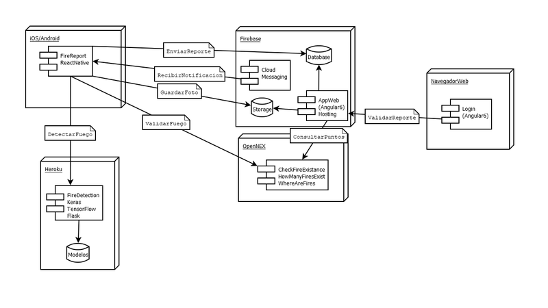
Report a fire
- Mobile application takes georeferenced photo.
Verify and define fire reports
- Current stage
- Validation with the NASA Open NEX API
- Web application to inform
- Future proposal
- Login for local authorities
- Decision support with Machin Learning
- Automatic fire detection in photos with Deep learning
Notify communities at risk
- Mobile application notifies nearby fires
Track and visualize fires
- It shows in the mobile application the fires and an optimal route in the map to a safe area
Create mashups
- Interactive map where the user queries fires in different parts of the world using API Open NEX

SpaceApps is a NASA incubator innovation program.