


Make my Art to sell on the Beach | Artify the Earth
The Challenge | Artify the Earth
Acessible Geotecnology
The use of geotechnical tools allows the manipulation and extraction of data obtained through NASA orbital images that can be used to interpret natural and social phenomenon that occur on the Earth's surface by using the free software Qgis.
Background
Theuse of geotechnical tools allows the manipulation and extraction ofdata obtained through orbital images that can be used to interpretphenomenonthat occur on the Earth's surface.
Theuse of images obtained through the NASA’sdatabase allows us to tailor this information in a playful way tofacilitate the access of this knowledge, both scientifically and foreducational purposes.
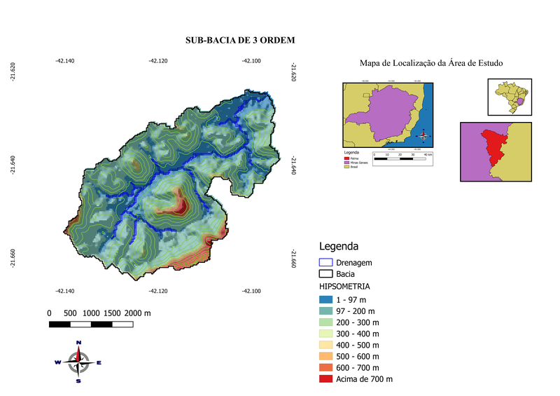
Thisproject aims to manipulate orbital images, extract data, createelevation models, delineate watersheds and create thematic maps usingthe free software: Qgis in version 2.14 Essen, transforming NASA’sorbital images into aneducational art.
Resources:
Images used in the project were obtained from the United States Geological Survey (https://earthexplorer.usgs.gov/).
The tool used for image manipulation was the open source QGIS software available at (https://qgis.org/en/site/).
Challenges Faced:
The challenge of this project was the manipulation of orbital images, data extraction, creation of elevation models, delimitation of watersheds and the creation of thematic maps through the use of free software Qgis in version 2.14 Essen, transforming orbital images of NASA inan educational art in 24 hours.
The orbital images transformation can also be used to extract and interpretate datas that may explain phenomenons on rocky surfaces of others planets beyond earth, like Mars.

SpaceApps is a NASA incubator innovation program.