


GeoSim | 1D, 2D, 3D, Go!
Awards & Nominations
GeoSim has received the following awards and nominations. Way to go!
The Challenge | 1D, 2D, 3D, Go!
G-Sim
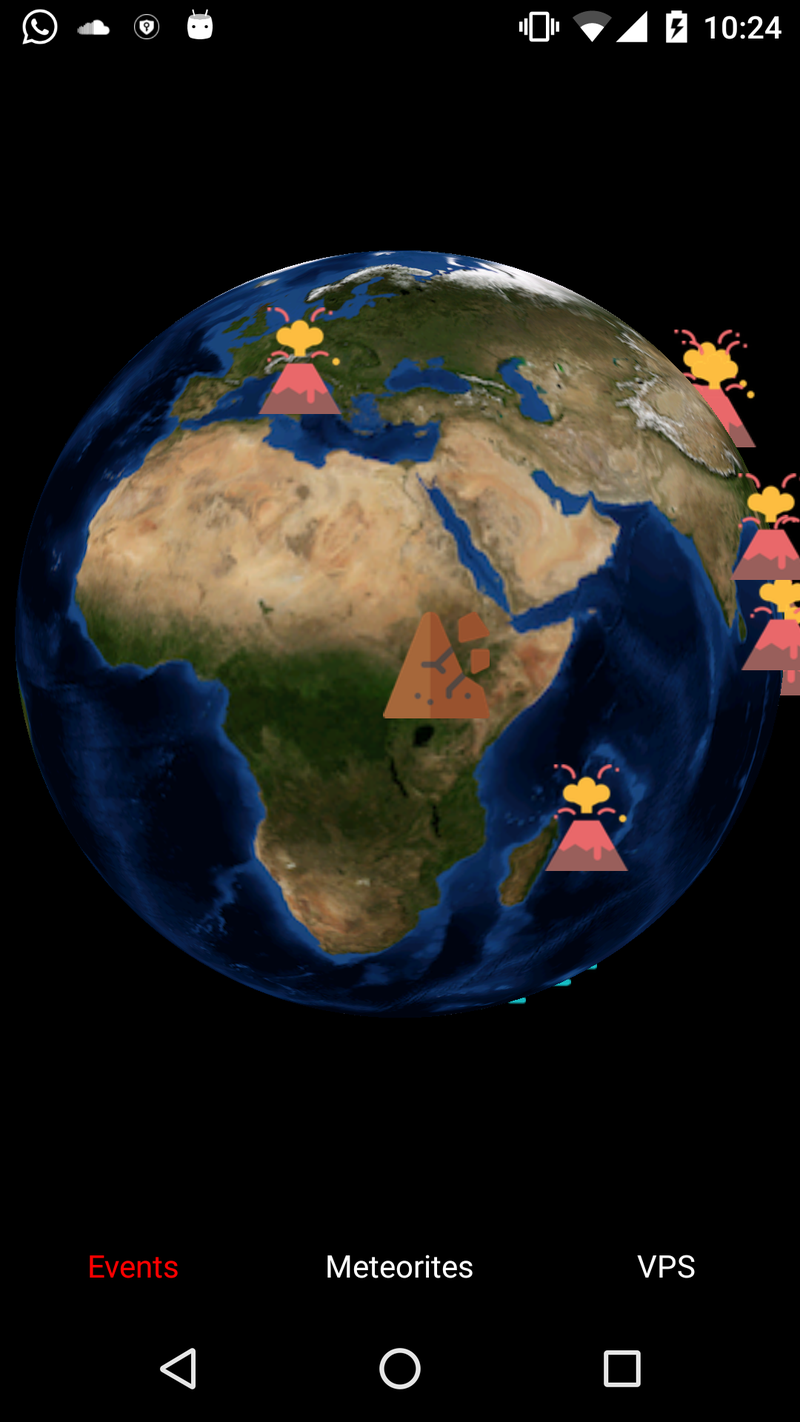
G-Sim is an interactive mobile app that uses cutting edge technologies to make the planet easier to study and guide the user to find near geological events.
The Problem:
The hard accessibility of data from NASA's open data. If you found the required data, it will take you a lot of effort to visualize it in an understandable way to the students.
The solution:
Creating a tool that enables the students to access all the data they need to study earth science in a fast, easy, and attractive way.
Also, we provide a service for non-students to locate the nearest landmark or see some cool information about the surrounding area.
The Goal:
- Help students in their Geological studies and travelers to explore the Earth.
- Widen the people's gaze and make them see the beauty around them.
The resources:
- we have used NASA's open data to collect APIs for different geological feature of the earth: https://api.nasa.gov/api.html
- Weather data has been collected from: https://openweathermap.org/api
- Virtual positioning system technology from Google: https://www.androidauthority.com/google-maps-visua...
- We have used Android studio to make the app.
Description of the App:
G-Sim app uses NASA's open data to illustrate the geological features in the Earth, using technologies like Augmented reality, Virtual positioning system, and Natural language processing. The challenge faced us was to convert the data into an API to link the data to the 3D model of Earth. We were trying to use IBM cloud to convert some of the data from NASA and Open weather database into API to integrate all of the data. Using these techniques, G-Sim will be able to give an overview of the geological and atmospheric features of a unique place to the user.
download here : https://drive.google.com/open?id=1xEBAZwEV6_PCI7Ov...

SpaceApps is a NASA incubator innovation program.